PK5-12 Redevelopment Plan
The PK5-12 Redevelopment Master Plan, Libreville, Gabon, describes policies, strategies, and actions, in image and text format, for the land extending about one-to-two kilometers on north and south of the PK5-12 roadway’s seven kilometer fixed corridor. The planning area encompasses sections of arrondissement three, five and six. The Master Plan:
Reconfigures existing settlements into future SmartCoded neighborhoods, improve existing roads, add new roads, footpaths and water and wastewater infrastructure, and add new buildings and parks.
Identifies areas where new housing and businesses might be inserted, and where redevelopment of sites could add social housing to help meet the overall demand.
Reconfigures existing neighborhood corridors to increase the quantity and quality of vehicle and pedestrian thoroughfares, intersections, and connections within and between developed areas, and identifies areas where new roads and pedestrian connections might be developed.
Reconfigures existing parks and other civic spaces to make them more useful, and identify where new parks and other civic spaces could be added within and between settlements
Improves existing, natural corridors, and/or create new stormwater drainages to increase the quantity and quality of stormwater collection, conveyance, and detention.
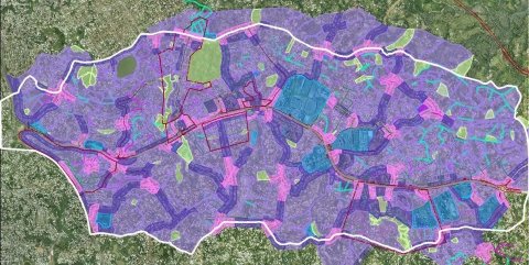
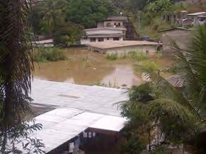
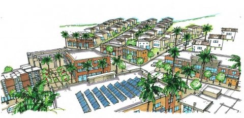
Image, top: Transect Regulating (Zoning) Plan Middle: The area remains prone to periodic flooding which our plan mitigates Bottom: 3D Intersection design